![](/images/other/stat-length.png)
PF-La Tour d'Aigues - La Bastidonne - La Chapelle St Julien
MicDul
Benutzer GUIDE
![Länge](/images/other/stat-length.png)
Länge
14,7 km
![Maximale Höhe](https://static1.geolcdn.com/siteimages/upload/files/1508320355ic_sort_altitude_max_24dp.png)
Maximale Höhe
448 m
![Positive Höhendifferenz](https://static1.geolcdn.com/siteimages/upload/files/1508320355ic_sort_den_pos_24dp.png)
Positive Höhendifferenz
302 m
![Km-Effort](/images/other/stat-length.png)
Km-Effort
18,8 km
![Min. Höhe](https://static1.geolcdn.com/siteimages/upload/files/1508320355ic_sort_altitude_min_24dp.png)
Min. Höhe
231 m
![Negative Höhendifferenz](https://static1.geolcdn.com/siteimages/upload/files/1508320355ic_sort_den_neg_24dp.png)
Negative Höhendifferenz
302 m
![Boucle](https://static1.geolcdn.com/siteimages/upload/files/16400158638029165_repeat_loop_refresh_sync_direction_icon.png)
Boucle
Ja
Erstellungsdatum :
2023-02-07 08:43:23.0
Letzte Änderung :
2023-02-08 10:51:48.024
![Wandern](https://static1.geolcdn.com/sitytour/trail-icons/101.png)
4h45
Schwierigkeit : Medium
![Scannen Sie diesen QR-Code, um die Tour in der SityTrail-Anwendung zu öffnen](https://capi.geolives.com/qq0zvz2zws4bq2lad0pu/sitytour/trails/3543742/qr.png?size=200)
Kostenlosegpshiking-Anwendung
Über SityTrail
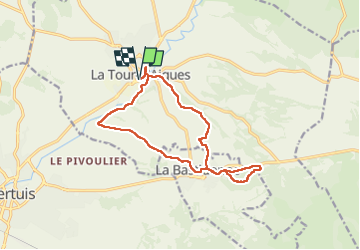
Tour Wandern von 14,7 km verfügbar auf Provence-Alpes-Côte d'Azur, Vaucluse, La Tour-d'Aigues. Diese Tour wird von MicDul vorgeschlagen.
Beschreibung
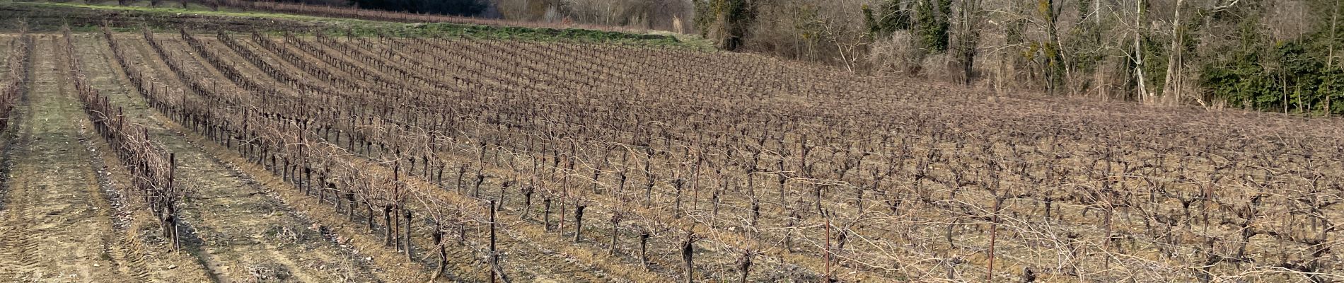
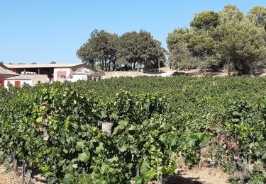
On traverse l'univers privilégié du vin (AOC Luberon) dont les parcelles s'étendent à perte de vue entre La Tour d'Aigues et la Bastidonne.
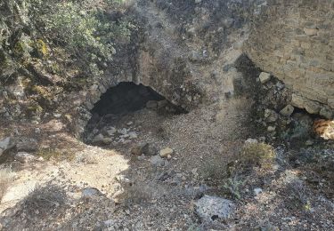
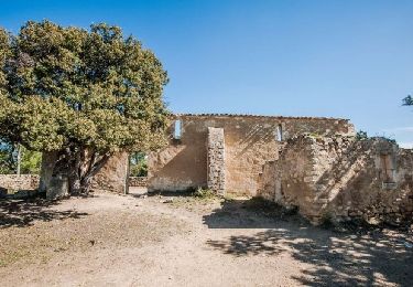
Rando cool, un tout petit raidillon pour atteindre les ruines de la Chapelle St Julien.
Ort
Land:
France
Region :
Provence-Alpes-Côte d'Azur
Abteilung/Provinz :
Vaucluse
Kommune :
La Tour-d'Aigues
Standort:
Unknown
Gehen Sie:(Dec)
Gehen Sie:(UTM)
705209 ; 4844304 (31T) N.
Kommentare
Touren in der Umgebung
![Tour Fahrrad La Tour-d'Aigues - Le Pays d'Aigues à vélo - Photo](https://media.geolcdn.com/t/375/260/ext.jpg?maxdim=2&url=https%3A%2F%2Fservices.sitytrail.com%2FGeolivesWS%2FDownloadMedia.ashx%3FTrailID%3D375429%26Media%3D99a489f7-2858-43fb-ba44-5a56cc4c2d83.jpg)
![Fahrrad Fahrrad](https://static1.geolcdn.com/sitytour/trail-icons/200.png)
Le Pays d'Aigues à vélo
Fahrrad
Medium
(2)
La Tour-d'Aigues,
Provence-Alpes-Côte d'Azur,
Vaucluse,
France
![](/images/other/stat-length.png)
86 km | 102 km-effort
5h 49min
![](https://static1.geolcdn.com/siteimages/upload/files/16400158638029165_repeat_loop_refresh_sync_direction_icon.png)
Ja
![Tour Wandern Grambois - 2024-10-01 Grambois et les ruines des templiers - Photo](https://media.geolcdn.com/t/375/260/34aa4f0a-eb41-4073-9dd4-50b69dbe410b.jpg&format=jpg&maxdim=2)
![Wandern Wandern](https://static1.geolcdn.com/sitytour/trail-icons/101.png)
2024-10-01 Grambois et les ruines des templiers
Wandern
Schwierig
Grambois,
Provence-Alpes-Côte d'Azur,
Vaucluse,
France
![](/images/other/stat-length.png)
12 km | 16 km-effort
3h 38min
![](https://static1.geolcdn.com/siteimages/upload/files/16400158638029165_repeat_loop_refresh_sync_direction_icon.png)
Ja
![Tour Mountainbike La Bastidonne - La Bastidonne 2015 - Photo](https://media.geolcdn.com/t/375/260/ext.jpg?maxdim=2&url=https%3A%2F%2Fstatic1.geolcdn.com%2Fsiteimages%2Fupload%2Ffiles%2F1524743154velo.jpg)
![Mountainbike Mountainbike](https://static1.geolcdn.com/sitytour/trail-icons/202.png)
La Bastidonne 2015
Mountainbike
Medium
(1)
La Bastidonne,
Provence-Alpes-Côte d'Azur,
Vaucluse,
France
![](/images/other/stat-length.png)
24 km | 28 km-effort
1h 51min
![](https://static1.geolcdn.com/siteimages/upload/files/16400158638029165_repeat_loop_refresh_sync_direction_icon.png)
Ja
![Tour Wandern La Tour-d'Aigues - la tour d aigues la bastidonne - Photo](https://media.geolcdn.com/t/375/260/a6ede015-e8f8-4fd7-91d3-0d454d18b365.jpg&format=jpg&maxdim=2)
![Wandern Wandern](https://static1.geolcdn.com/sitytour/trail-icons/101.png)
la tour d aigues la bastidonne
Wandern
La Tour-d'Aigues,
Provence-Alpes-Côte d'Azur,
Vaucluse,
France
![](/images/other/stat-length.png)
14,2 km | 18,1 km-effort
4h 7min
![](https://static1.geolcdn.com/siteimages/upload/files/16400158638029165_repeat_loop_refresh_sync_direction_icon.png)
Nein
![Tour Wandern La Tour-d'Aigues - Vignes du Château de la Dorgonne - Photo](https://media.geolcdn.com/t/375/260/99d53b3f-ad8c-4fd6-a9d1-394e59e3537b.jpg&format=jpg&maxdim=2)
![Wandern Wandern](https://static1.geolcdn.com/sitytour/trail-icons/101.png)
Vignes du Château de la Dorgonne
Wandern
Sehr leicht
La Tour-d'Aigues,
Provence-Alpes-Côte d'Azur,
Vaucluse,
France
![](/images/other/stat-length.png)
6,3 km | 8,1 km-effort
1h 32min
![](https://static1.geolcdn.com/siteimages/upload/files/16400158638029165_repeat_loop_refresh_sync_direction_icon.png)
Ja
![Tour Wandern La Motte-d'Aigues - Étang de la Bonde - Photo](https://media.geolcdn.com/t/375/260/ext.jpg?maxdim=2&url=https%3A%2F%2Fservices.sitytrail.com%2FGeolivesWS%2FDownloadMedia.ashx%3FTrailID%3D873376%26Media%3Dfix__20171208143802.jpg)
![Wandern Wandern](https://static1.geolcdn.com/sitytour/trail-icons/101.png)
Étang de la Bonde
Wandern
Sehr leicht
La Motte-d'Aigues,
Provence-Alpes-Côte d'Azur,
Vaucluse,
France
![](/images/other/stat-length.png)
3,1 km | 3,6 km-effort
40min
![](https://static1.geolcdn.com/siteimages/upload/files/16400158638029165_repeat_loop_refresh_sync_direction_icon.png)
Ja
![Tour Wandern La Tour-d'Aigues - La tour d'Aigues - Photo](https://media.geolcdn.com/t/375/260/ext.jpg?maxdim=2&url=https%3A%2F%2Fstatic1.geolcdn.com%2Fsiteimages%2Fupload%2Ffiles%2F1553511878bg_sport_marche.png)
![Wandern Wandern](https://static1.geolcdn.com/sitytour/trail-icons/101.png)
La tour d'Aigues
Wandern
Einfach
(1)
La Tour-d'Aigues,
Provence-Alpes-Côte d'Azur,
Vaucluse,
France
![](/images/other/stat-length.png)
14,4 km | 18,2 km-effort
3h 59min
![](https://static1.geolcdn.com/siteimages/upload/files/16400158638029165_repeat_loop_refresh_sync_direction_icon.png)
Ja
![Tour Fahrrad La Tour-d'Aigues - La Tour Cucuron - Photo](https://media.geolcdn.com/t/375/260/ext.jpg?maxdim=2&url=https%3A%2F%2Fstatic1.geolcdn.com%2Fsiteimages%2Fupload%2Ffiles%2F1524743154velo.jpg)
![Fahrrad Fahrrad](https://static1.geolcdn.com/sitytour/trail-icons/200.png)
La Tour Cucuron
Fahrrad
Einfach
(1)
La Tour-d'Aigues,
Provence-Alpes-Côte d'Azur,
Vaucluse,
France
![](/images/other/stat-length.png)
27 km | 32 km-effort
1h 50min
![](https://static1.geolcdn.com/siteimages/upload/files/16400158638029165_repeat_loop_refresh_sync_direction_icon.png)
Ja
![Tour Fahrrad La Tour-d'Aigues - En passant par la montagne - Photo](https://media.geolcdn.com/t/375/260/ext.jpg?maxdim=2&url=https%3A%2F%2Fstatic1.geolcdn.com%2Fsiteimages%2Fupload%2Ffiles%2F1524743154velo.jpg)
![Fahrrad Fahrrad](https://static1.geolcdn.com/sitytour/trail-icons/200.png)
En passant par la montagne
Fahrrad
Einfach
(1)
La Tour-d'Aigues,
Provence-Alpes-Côte d'Azur,
Vaucluse,
France
![](/images/other/stat-length.png)
18,6 km | 23 km-effort
1h 40min
![](https://static1.geolcdn.com/siteimages/upload/files/16400158638029165_repeat_loop_refresh_sync_direction_icon.png)
Ja